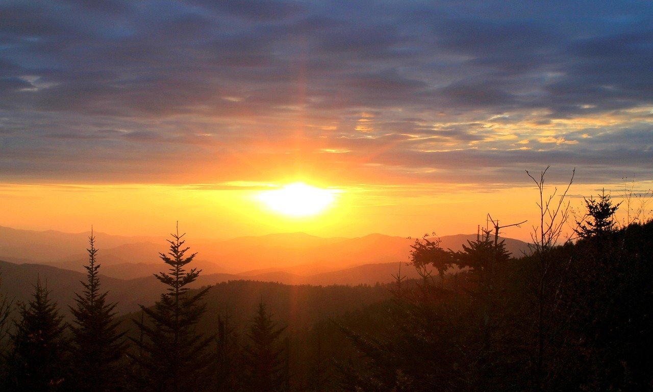
Great Smoky Mountains National Park is the most-visited national park in the country, and its trail system reflects that range of visitors — from serious backcountry hikers to families out for an hour-long walk to a waterfall. The park doesn’t charge an entrance fee, which makes it easy to visit for a short trail without committing to a full day, but it does require a parking tag for any stop longer than 15 minutes. This guide focuses specifically on trails that suit hikers who are new to the park, new to hiking in general, or traveling with kids or a range of fitness levels in the same group.
Why the Smokies work well for beginners — and where the honest limits are

The Smokies’ beginner-friendly reputation comes from genuine variety: paved paths, short waterfall hikes, and one of the only spots in the eastern US where you can drive to within a mile of a 6,000-foot peak. Trailheads are generally well-marked and close to parking, and several of the most rewarding hikes here are under three miles round trip.
The honest limit is that “beginner” in the Smokies still means real elevation change on many of these trails — this is mountain terrain, not flat parkland. Weather shifts quickly at higher elevations, humidity is significant for most of the year, and popular trailheads fill their parking lots by mid-morning on weekends and during October’s leaf season. None of that rules out a great first hike here, but it changes how you should plan the day.
Best time to go
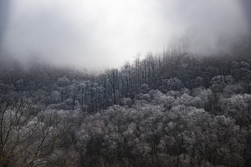
Spring (April-May) brings wildflower blooms across lower-elevation trails, along with high water flow that makes waterfall hikes especially dramatic. Fall (mid-September through early November) is the park’s signature season, with leaf color moving from higher to lower elevations over several weeks — also the single busiest period for trailhead parking. Summer is warm and humid, particularly at lower elevations, though higher-elevation trails like those near Clingmans Dome stay noticeably cooler. Winter thins the crowds substantially and keeps most lower-elevation trails accessible, though higher elevations can see snow and ice, and some roads (including the spur to Clingmans Dome) close seasonally.
How to get there and get around
Gatlinburg, Tennessee and Cherokee, North Carolina are the two main gateway towns, sitting on opposite sides of the park and connected by Newfound Gap Road, which crosses the spine of the Smokies. Most visitors fly into Knoxville, Tennessee (roughly 45-60 minutes from Gatlinburg) or Asheville, North Carolina (roughly 1.5 hours from Cherokee).
Unlike many Western parks, the Smokies has no shuttle system for most trailheads — a personal or rental vehicle is the standard way to get around, and a parking tag is required for any vehicle parked longer than 15 minutes anywhere in the park. Daily tags cost $5, weekly tags $15, and annual tags $40, purchasable online in advance or at machines throughout the park (though many trailheads themselves don’t have a machine on site, so buying ahead is worth the small effort).
A realistic USD budget
Because there’s no park entrance fee, the Smokies is one of the more affordable national parks to visit for a day trip — the parking tag is the only mandatory park-specific cost.
**Budget tier (roughly $100-140/day per person):** Camping or a budget motel in Gatlinburg, Pigeon Forge, or Cherokee, self-catered meals, and the $5 daily parking tag.
**Mid-range tier (roughly $180-260/day per person):** A comfortable hotel or cabin rental near the park, a mix of restaurant and grocery meals, and perhaps a guided hike or horseback tour as an add-on.
**Upscale tier ($320+/day per person):** A well-appointed cabin or boutique lodging with mountain views, dining primarily at sit-down restaurants, and a private guide for a more in-depth hike or wildlife-focused outing.
The best beginner trails
**Laurel Falls Trail (2.6 miles/4.2 km round trip, easy-to-moderate).** The single most popular hike in the park for good reason: a paved path leads to an 80-foot waterfall, with a gentle but steady incline the whole way. The pavement makes it accessible for strollers and a wide range of fitness levels, though it does narrow near the falls with some drop-offs, so keep a close eye on kids. Arrive early — this trailhead’s small parking area fills quickly, especially on weekends.
**Cataract Falls (roughly 0.6-1 mile/1-1.6 km round trip depending on starting point, easy).** A short, mostly flat walk to a modest waterfall, accessible from near the Sugarlands Visitor Center. This is a strong choice for a quick stop or for very young kids, since it delivers a genuine waterfall payoff without much walking.
**Gatlinburg Trail (3.8 miles/6.1 km round trip, easy).** One of only two trails in the park that allow leashed dogs, running along the (typically dry-ish) creek between Sugarlands Visitor Center and downtown Gatlinburg. Flat and wide, this trail works well for an easy morning walk, and its two-town connection means you could start in Gatlinburg and walk into the park rather than the other way around.
**Cades Cove Loop and short nature trails.** Cades Cove itself is an 11-mile one-way loop road rather than a hike, but it’s built around a series of short, easy nature trails and historic homestead stops, plus some of the best wildlife-viewing odds in the park (deer and occasionally black bear are commonly spotted from the roadside, especially at dawn and dusk). This is less a single trail and more a full beginner-friendly day, combining driving, short walks, and photo stops.
**Grotto Falls via Trillium Gap Trail (2.6 miles/4.2 km round trip, moderate).** A step up in difficulty from Laurel Falls and Cataract Falls, with a natural dirt trail through old-growth forest, but the payoff is unusual: this is the only waterfall in the park you can walk behind. Some elevation gain throughout makes this feel more like a “real” hike while remaining manageable for most beginners in reasonable shape.
**Clingmans Dome Trail (1 mile/1.6 km round trip, steep but short).** A paved path — the only one of its kind at this elevation in the park — climbing to an observation tower at 6,643 feet (2,025 m), the highest point in the Smokies and in Tennessee. The grade is genuinely steep for its short length, which surprises some visitors expecting an easy stroll because it’s paved, but the payoff is a 360-degree view that, on a clear day, can extend over 100 miles. The access road closes seasonally in winter, so confirm current status before planning around it.
**Deep Creek Waterfalls Loop (roughly 2.4-4.6 miles/3.9-7.4 km depending on route, easy-to-moderate).** Based near Bryson City on the North Carolina side, this loop passes three waterfalls (Toms Branch, Indian Creek, and Juney Whank) and is notably less crowded than the Gatlinburg-side trails, making it a strong pick for beginners who want a quieter experience.
Where to stay
**Gatlinburg** puts you closest to Laurel Falls, Cataract Falls, Clingmans Dome, and the Gatlinburg Trail, with the widest range of dining and lodging density of any gateway town, though it’s also the busiest and most tourist-oriented. **Pigeon Forge**, just north of Gatlinburg, offers similar proximity with a broader mix of family-oriented attractions beyond the park itself. **Townsend**, on the park’s quieter “peaceful side,” sits closer to Cades Cove and suits travelers who’d rather avoid the busier strip entirely. **Cherokee and Bryson City**, on the North Carolina side, put you closer to Deep Creek and the less-trafficked southern half of the park, with a noticeably different, quieter pace than Gatlinburg.
Safety, packing, and common mistakes
Trails here can be more slippery than they look — wet rocks near waterfalls are a leading cause of minor injuries, so sturdy footwear with real tread matters more than it might seem to on a “beginner” trail. Weather changes quickly at higher elevations; even a warm morning at Cades Cove can be 15-20°F (8-11°C) cooler and windier at Clingmans Dome, so pack a layer regardless of season. Black bears are present throughout the park — keep a respectful distance, never approach or feed wildlife, and store food properly at any picnic or camp stop. Cell service is unreliable across most of the park, so download offline maps and let someone know your planned route before setting out. The most common mistake beginners make here is underestimating trailhead parking demand during leaf season — arriving by mid-morning is often too late at the most popular trailheads between late September and early November.
FAQ
**Is there an entrance fee for Great Smoky Mountains National Park?** No — it’s one of the only major national parks without an entrance fee. A parking tag is required instead for any vehicle parked longer than 15 minutes: $5 daily, $15 weekly, or $40 annually.
**Which trail is best for young kids?** Cataract Falls is the shortest and flattest option with a genuine payoff, making it a strong choice for very young children or anyone who wants a quick, low-effort walk.
**Can I bring my dog on Smoky Mountains trails?** Only on two trails in the entire park: the Gatlinburg Trail and the Oconaluftee River Trail near Cherokee. Dogs are not permitted on any other park trails, which surprises many visitors.
**Do I need to book a permit for these beginner trails?** No day-hiking permit is required for any of the trails listed here. Permits apply to overnight backcountry camping, which isn’t part of a typical beginner day hike.
**Is Clingmans Dome open year-round?** The trail itself is generally accessible when the access road is open, but the road closes seasonally in winter (typically December through March, though this varies by year and current conditions) — check the park’s current road status before planning a visit.
**How crowded do these trails get?** Laurel Falls and the Cades Cove area are consistently among the busiest spots in the park, especially on weekends and during October. Deep Creek on the North Carolina side and Cataract Falls tend to be noticeably quieter alternatives with a similar level of difficulty.
Next Step
Pick two trails from this list that pair well logistically — say, Cataract Falls and Laurel Falls on the same morning near Sugarlands, or Grotto Falls combined with a Cades Cove drive — rather than trying to string together every highlight in a single rushed day.
Related Travytour guides
- [Best Small Towns Near Yellowstone to Stay In](/where-to-stay-near-yellowstone/)
- [Utah’s Mighty 5 National Parks Road Trip Itinerary](/utah-national-parks-road-trip/)
- [Best National Parks to Visit in the Off-Season (And What to Expect)](/national-parks-off-season/)