Editorial deck: A first Eryri mountain day begins with an honest choice between a lower-level learning walk and a strenuous Yr Wyddfa attempt—not with a promise that every beginner can reach the summit.
Your first mountain walk in Eryri—also known as Snowdonia—does not need to end on Yr Wyddfa, the highest summit in Wales. The most useful first day may be a lower route where you practise pacing, layers, navigation and turning around while consequences remain manageable.
This guide offers three outcomes. Choose a lower-level walk such as the official Cwm Idwal route; attempt Yr Wyddfa by the Llanberis Path only after passing clear fitness, skill, weather and equipment gates; or choose a no-go day when those gates fail. None is a lesser result. The goal is to return under your own power with enough margin to understand what you learned.
The Eryri National Park Llanberis Path page classifies that summit route as hard/strenuous, requires a good level of fitness and says navigation skills are essential. “Often called the easiest route” does not mean easy, safe in all conditions or suitable for every first-time walker.
Begin with the AdventureSmart questions
Before selecting a route, answer the three questions used by AdventureSmart:
- Do you have the knowledge and skills for this specific day?
- Do you understand the weather for the full route and time outside?
- Do you have the gear required for the conditions?
Answer for the least-experienced and least-fit member of the group, not the strongest. A “no” sends you to a lower route, a qualified guide or another day. It does not invite you to hope that the railway, café, phone or other walkers will close the gap.
A summit ambition also needs a recent fitness trial. Complete a sustained lower walk while carrying the pack and footwear you intend to use. Notice pace, comfort on uneven ground, food and water needs and how the group responds when tired. If that trial exposes pain, navigation gaps or an unrealistic pace, use the lower-level plan.
Choose one of three day products
Product A: a lower-level first mountain walk
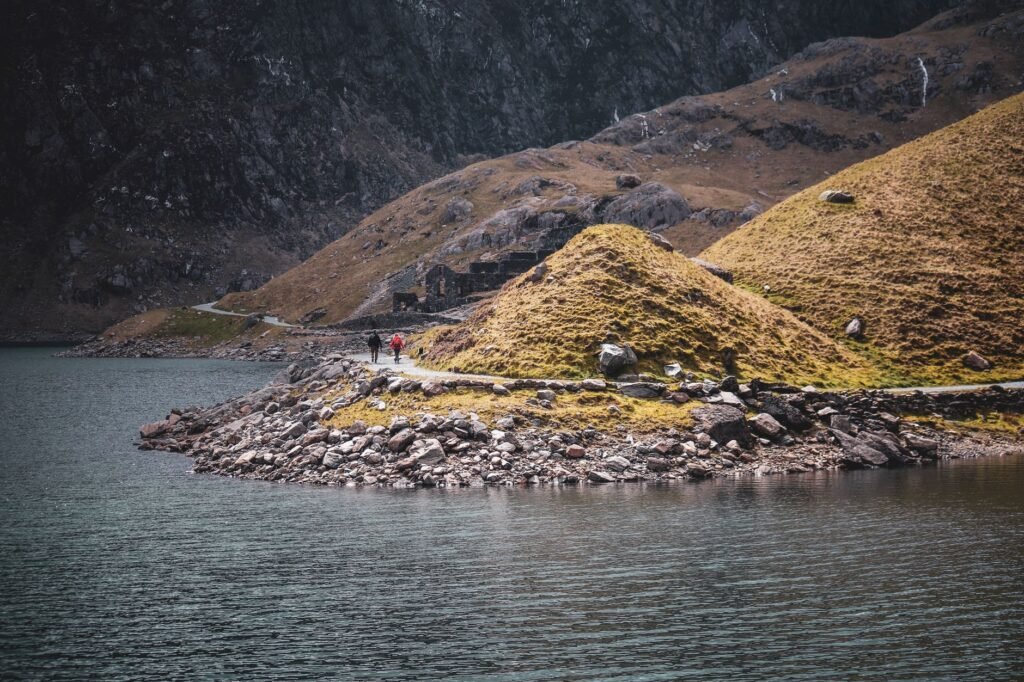
The official Cwm Idwal route provides a defined national-park walk in a dramatic glacial landscape without requiring an Yr Wyddfa summit. It is still an outdoor route with uneven or wet ground and rapidly changing upland weather. Read its current route details, use the named start, check local notices and follow only the selected circuit.
This day is for practising skills deliberately:
- Locate yourself on the map before moving.
- Match visible features to the route at every junction.
- Adjust layers before becoming soaked or chilled.
- Eat and drink before energy falls sharply.
- Agree a turn-around trigger and use it.
- Record the actual time and effort for future planning.
If Cwm Idwal does not suit current weather, choose an even lower signed route from the national park’s live directory. Do not improvise an extension up a ridge simply because the main circuit felt comfortable.
Product B: conditional Yr Wyddfa summit attempt
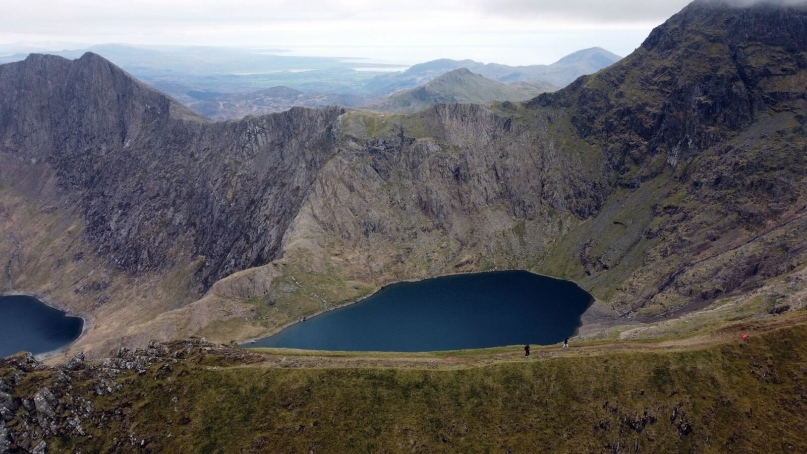
Choose the Llanberis Path only when every summit gate passes. The park publishes the route as a there-and-back mountain day with substantial ascent and classifies it hard/strenuous. Use the current official route page, downloadable route information and a suitable map. Know how to navigate rather than merely following the crowd or railway.
The same path can feel very different in low cloud, strong wind, heavy rain, heat, snow or ice. If wintry ground is present anywhere on the route, a summer walking plan no longer applies. Specialist equipment without the skill to use it is not a solution; select the lower walk or obtain appropriate instruction.
Your summit plan must include walking back down. A train seat, open café or mobile signal cannot be part of the safety case. Set a turn-around time based on forecast daylight, group pace and deteriorating-weather thresholds. The summit is optional; the planned descent is not.
Product C: no-go or skills day
Choose no-go when the mountain forecast is outside the group’s competence, roads or transport prevent a clean start, essential equipment is missing, or a walker is unwell or injured. Use the day to practise map-and-compass skills in an appropriate safe setting, visit a national-park information centre, refit equipment or take formal instruction.
Changing the objective before departure is good mountain judgement. Do not replace a cancelled summit with an unresearched route elsewhere in Eryri.
Read mountain weather, not a valley icon
The Met Office mountain-safety guidance explains that hill conditions can be far more severe than in valleys and directs walkers to dedicated mountain forecasts. Read the Snowdonia mountain forecast for wind, precipitation, cloud, visibility, temperature and hazards, then compare it with the hours you expect to be exposed.
Ask practical questions:
- Can everyone remain stable and warm in the forecast wind and temperature?
- Will cloud remove the landmarks your navigation plan relies on?
- Could rain or previous rainfall change streams, footing or the consequences of a slip?
- Does the group have enough daylight margin if movement is slower than expected?
- Is any snow or ice forecast or reported that changes the equipment and skills required?
Reassess during the walk. A forecast describes expected conditions, not a guarantee. Turn back when reality becomes worse than the agreed threshold, before the group is exhausted.
Route and navigation plan
Download the official route for review, but carry navigation that works when a phone is wet, cold, broken or without signal. AdventureSmart’s gear guidance recommends a map and compass and the skill to use them, plus a charged phone without relying on it as the sole navigation or communication tool.
Before departure, mark:
- the correct start and finish;
- significant junctions and terrain features;
- places where taking the wrong branch creates a different mountain route;
- the planned turn-around time;
- safe retreat along the same known route;
- the grid reference or location format you could give rescuers.
On Llanberis Path, keep off the railway tracks. Their proximity is neither a handrail nor permission to use rail infrastructure. In poor visibility, stop and confirm position before moving; do not follow an unknown group on the assumption that they have checked the route.
Getting to the correct trailhead
Parking depends on the route. The national park’s Yr Wyddfa parking guide links each summit path to suitable official parking, advises against roadside and residential obstruction and highlights the narrow road near Pen y Pass. Do not search for “Snowdon parking” and then walk along a dangerous road to a different start.
The Sherpa’r Wyddfa network serves summit-route trailheads, but use the live journey for the exact date and direction. Protect the last return and allow for the walk from the stop. A bus route number copied months earlier is not evidence of service on your day.
For Llanberis Path, use the official page’s current directions and Llanberis transport information. For Cwm Idwal, use that route’s own starting-point and access details. If legal parking or the booked bus fails, change the route; never use a verge, gateway or residential street as an unofficial substitute.
The railway is a separate product, not a rescue plan
Snowdon Mountain Railway sells a dated visitor product controlled by its own plan-your-visit page. Destination, operating period and access can change with weather or technical conditions. Walking up does not guarantee transport down: descent-only tickets cannot be reserved in advance and are subject to availability. The operator explicitly tells hikers to be prepared to walk back down.
Do not buy or imagine a rail “bailout” to compensate for fitness, injury or late departure. A booked return rail journey is also not a flexible hiking ticket; follow the exact operator rules. If combining any walking with a rail product, verify the current permitted product and ensure the walking element remains safe without an unconfirmed seat.
Hafod Eryri and other refreshments or toilets may close or be inaccessible when trains cannot reach the summit. Carry enough food, water and shelter for the entire self-powered route. Commercial facilities are bonuses, never dependencies.
Pack by function
Choose equipment for the selected route and forecast, then test it before the mountain day. A useful core system includes:
- a waterproof outer layer and insulation that still works when resting;
- footwear that fits, has suitable grip and has been tested on comparable ground;
- route map, compass and the skill to use both;
- charged phone in weather protection plus a power reserve;
- head torch, even when a daylight return is planned;
- sufficient food and water for the complete route plus delay;
- small first-aid supplies and any essential personal medication;
- hat, gloves and sun protection as conditions require;
- an emergency layer or shelter appropriate to the group and exposure.
“Boots, not trainers” is too blunt to make the decision for every person and route. Fit, grip, support, waterproofing, ground and experience all matter. If you cannot judge whether your footwear fits the day, ask a competent instructor or outdoor specialist before departure.
A realistic summit-day sequence
The night before, save the official route and transport information, pack the complete kit and identify the morning forecast update. Share the route and expected return with a responsible contact.
In the morning, rerun the skills–weather–gear gate. Confirm every group member is healthy and willing. Verify parking or the outward and return buses. Cancel early if a required element fails.
At the start, locate the group on the map and note actual departure time. Walk at a pace the group can sustain while talking, taking short purposeful breaks rather than exhausting surges. At every main junction, confirm the route and return direction.
At the agreed decision point, compare actual pace, remaining food and water, group condition, weather and daylight with the plan. Turn around if any margin has disappeared. Do not let closeness to the summit erase the descent calculation.
At the end, tell the responsible contact you are down and review what worked. Pain, blisters, navigation uncertainty or an unexpectedly slow descent become inputs for the next route—not stories to ignore.
Children, solo walkers and guided alternatives
There is no universal age or “reasonably fit beginner” rule for the Llanberis Path. Evaluate each person’s sustained walking experience, response to cold and wet, ability on uneven ground and willingness to turn back. The least-capable participant controls the route.
Solo walking adds decision and communication consequences. Leave a clear plan, carry independent navigation and be conservative about conditions. Other people on a popular path are not your support team.
If navigation, weather interpretation or group management is outside your competence, book a qualified guide for the exact route and date or take a skills course first. Verify the provider’s qualifications, scope, meeting point, equipment requirements, cancellation terms and what happens if the summit is unsuitable.
Emergency procedure
Preventing the emergency remains the priority. If one occurs, protect the group from immediate danger and further heat loss, give first aid within your competence and identify the location accurately.
In the UK, call 999 or 112, ask for Police, then Mountain Rescue. The Mountain Rescue England and Wales safety guidance explains preparation and how to summon help. If voice service is unavailable, an emergency SMS works only for users registered in advance; do not assume a message has sent.
Stay with the casualty unless remaining creates greater danger, follow the responder’s instructions and conserve phone battery. Rescue availability is not a reason to continue beyond the group’s limits.
Budget in GBP
Replace fixed USD-per-person tiers with a live pounds sterling (GBP) trip basket. Walking itself may not require an admission ticket, but the complete day can include transport, parking, accommodation, equipment, food and a guide.
Price these dated scenarios separately:
- Lower-walk day: transport/parking, any equipment hire, food and accommodation.
- Independent summit day: the same basket plus route/navigation preparation and contingency.
- Guided summit day: exact provider price, included equipment, transport and cancellation rules.
- Railway visitor day: exact dated railway product; do not mix it with an unconfirmed descent.
Compare refundable totals and record them in the Travytour budget calculator. The Travytour Wales hub contains wider planning context, while our editorial policy explains the verification approach.
Common beginner errors
- Reading “easiest summit route” as “easy route.”
- Making Yr Wyddfa the first-ever sustained hill walk without a fitness trial.
- Checking a town forecast instead of the mountain forecast.
- Relying on crowds, a phone, railway tracks or the café for navigation and safety.
- Assuming a train will provide the descent.
- Starting when parking or the return bus is unresolved.
- Carrying new footwear or untested waterproofs.
- Continuing because the summit looks close after the turn-around threshold.
- Switching to an unresearched route when the planned one is unsuitable.
The decision to take away
For a true beginner, the default is a defined lower-level Eryri route that teaches mountain habits. Yr Wyddfa via Llanberis Path becomes an option only when the park’s hard/strenuous classification matches proven fitness, navigation skill, equipment and the current mountain forecast.
Plan to descend on foot, make every facility optional and let the least-experienced walker veto the summit. Reaching home safely with better judgement is the achievement that prepares you for the next mountain.